
Inspection Software Case Study
Grid Analytics
Scalable Infrastructure Intelligence for Global Expansion – Enabling Real-Time Lidar & Visual Data Fusion, Automation, and Enterprise Delivery at Continental Scale
Client profile
Field Group is an industrial innovator combining software, sensor technology, and autonomous systems for critical infrastructure - serving sectors like energy, environment, construction, and public utilities. Following a merger, they accelerated growth and needed to scale their tech accordingly.
Challenge
The client had to take full ownership of their Grid Analytics platform and rebuild its architecture from the ground up. The system was stuck – only capable of processing a single inspection project at a time. There was no ability to correlate lidar and visual data from drone flyovers. Collision analysis was fragmented, defect detection unreliable, and the platform couldn’t support multi-client workflows. UX was outdated, backend performance was throttled by bottlenecks, and there was zero automation in place.
To succeed, the platform needed:
- Scalable architecture ready for multi-client, multi-project processing
- Real-time rendering of high-volume spatial data
- Automated detection of vegetation collisions and infrastructure damage
- Tight integration of lidar and drone imagery
- An agile team with domain-specific GIS and ML capabilities, ready to move fast and scale intelligently
This wasn’t a refactor. It was a rescue mission. Without a working platform, the client couldn’t deliver value, scale operations, or enter new markets. That made precision, execution, and velocity absolutely non-negotiable.
Our Strategic Approach
We proposed a complete re-architecture of the Grid Analytics platform – designed for scale, speed, and AI-powered automation from day one. Our solution included:
- Full platform migration to Google Cloud with CI/CD pipelines and automated quality checks
- Real-time spatial data visualization via redesigned UI/UX and Mapbox integration
- Modular backend built for elastic performance and parallel data processing
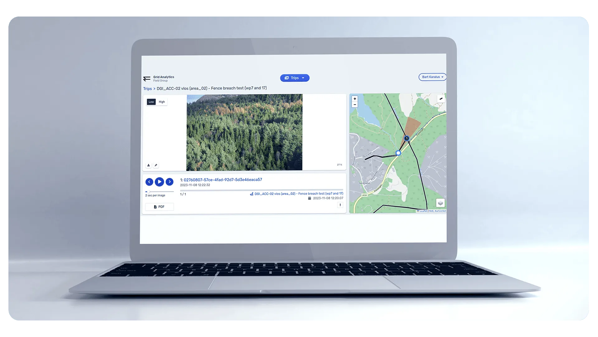
- AI/ML models trained to auto-detect infrastructure defects and vegetation risks
- Visual tagging and validation embedded into map view workflows for human review
From day one, the collaboration was built on clarity, ownership, and no-lag execution cycles.
No silos. No confusion. Just aligned teams executing at full velocity.
Execution: Built for Data Volume, Speed, and Global Scale
This wasn’t a rebuild. It was a complete system reinvention - designed to handle massive spatial data volumes, support enterprise-grade delivery, and unlock commercial scale across international markets.
Complete Re-Architecture & Migration
We tore down the legacy backend and rebuilt the platform on GCP using modern cloud-native patterns. The new infrastructure supports elastic scaling, secure multi-environment deployment, and global access with 99% uptime.
CI/CD Pipelines + Code Quality Automation
We implemented end-to-end DevOps pipelines with automated testing, code linting, and deployment gating. Every feature is shipped with quality assurance baked in — reducing defects and accelerating velocity.
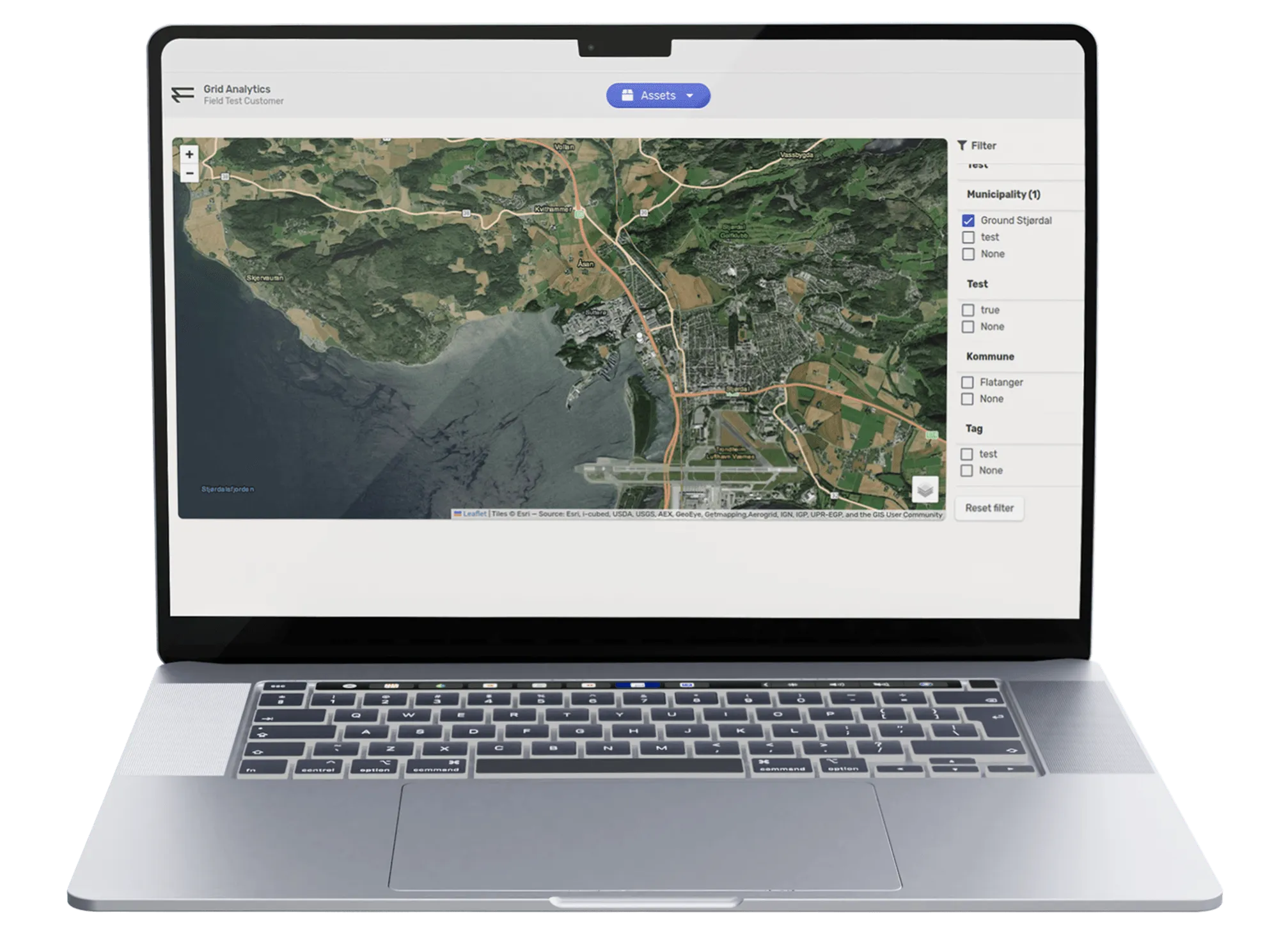
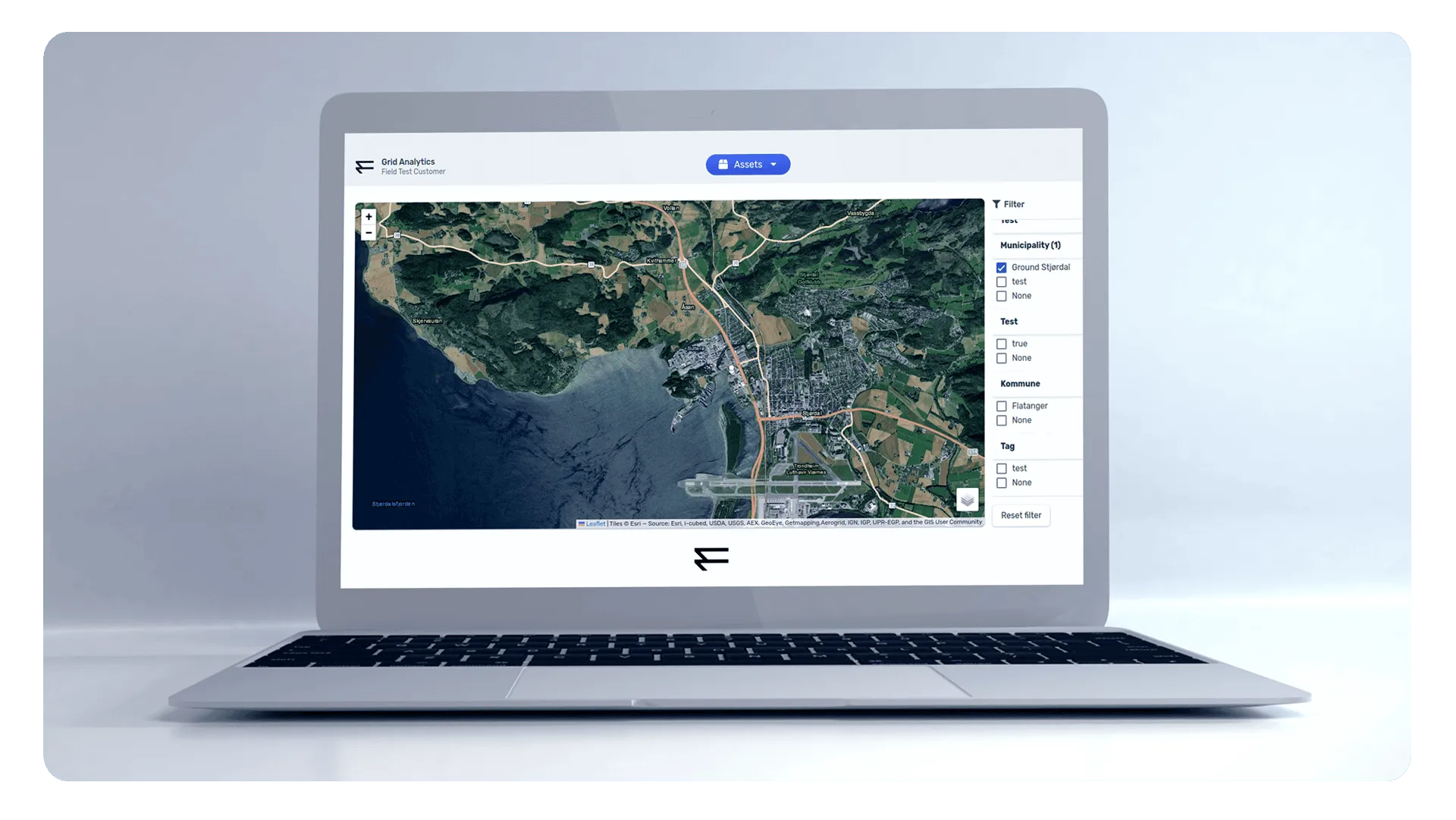
Modern UI/UX Layer Using Vue.js + Mapbox
The front-end was redesigned from the ground up using Vue.js and Mapbox for live, interactive spatial data rendering. Operators now see real-time geospatial insights in a clean, high-performance interface — optimized for both speed and usability.
AI/ML-Powered Detection Models
Our team built and trained deep learning models to detect vegetation encroachment and infrastructure defects from drone data. Auto-tagging, visual overlays, and confidence scoring allow human reviewers to validate findings directly within the map view.
Multi-Project Processing via Elastic Infrastructure
The platform now handles multiple client projects in parallel — no queueing, no resource contention. Whether running 1 job or 20, the system distributes compute dynamically and scales horizontally on demand.
End-to-End Agile Delivery Process
We introduced a full agile delivery model: sprint planning, retrospectives, QA gating, and performance velocity tracking. This structure ensured delivery was not just fast — it was accountable, measurable, and repeatable.
Grid Analytics Tech Stack
Grid Analytics was rebuilt on a modern, cloud-native stack to support real-time geospatial processing and scalable infrastructure insights.
The frontend is powered by Vue.js, delivering a responsive, operator-friendly UI, while Mapbox handles high-performance rendering of spatial, lidar, and visual data layers.
On the backend, MongoDB enables flexible management of unstructured geospatial datasets and inspection metadata. The system runs across both Google Cloud Platform (GCP) and Microsoft Azure, with multi-environment deployment supporting hybrid cloud needs and enterprise compliance.
End-to-end automation and release stability are maintained through GitLab CI/CD, ensuring consistent quality across staging and production.

Results:
The re-engineered Grid Analytics platform turned a technical liability into a scalable commercial asset — unlocking both operational throughput and international market entry.
Operational Outcomes
- Enabled weekly processing of 2–3 TB of drone-derived spatial data
- Achieved 99% system uptime via 3-environment deployment (dev/test/prod)
- Delivered unlimited project parallelism through elastic infrastructure
- Expanded data delivery capacity — unlocking onboarding of enterprise clients
- Fully ready for production delivery and white-label licensing across geographies
The system became the foundation for Field Group’s U.S. market expansion, providing the technical scale, reliability, and intelligence layer needed to compete globally.
- Transitioned from reactive processing to proactive intelligence delivery
- Moved from single-project limitations to true multi-client enterprise support
- Replaced technical debt with a productized IP advantage
This is no longer just an internal platform – it’s a growth engine and licensable asset powering Field Group’s positioning across North America and Europe.
Let’s build your
product together!
We shorten the time from problem to solution, which is why we focus on agile communication and action. We like to get straight to the point, so let’s schedule a free 15-minute consultation. No forms, no waiting.
Speak directly with Radek Lejsza, COO of Codeflyers

What our clients says about outcome of the collaboration?
We sent this question directly to our partners
Working with Codeflyers has been a game-changer for us! Their innovative approach and unparalleled technical expertise have propelled our project to new heights. We’re thrilled with the progress and their proactive attitude.
Christoffer Apneseth
CTO at Field
Our collaboration with Codeflyers is a perfect match! Their team is not only competent but also incredibly dedicated. The application is growing stronger, all thanks to their commitment and attention to detail.
Even Reitan
Strategy & Business Development Manager at Telenor
Scope of Services
Our partnership with TipTip encompassed a wide range of services:
Discovery Workshop
Working with Codeflyers has been a game-changer for us! Their innovative approach and unparalleled technical expertise have propelled our project to new heights. We’re thrilled with the progress and their proactive attitude.
Learn more >>
UX / UI Design
Working with Codeflyers has been a game-changer for us! Their innovative approach and unparalleled technical expertise have propelled our project to new heights. We’re thrilled with the progress and their proactive attitude.
Learn more >>
Mobile Appplication Development
Working with Codeflyers has been a game-changer for us! Their innovative approach and unparalleled technical expertise have propelled our project to new heights. We’re thrilled with the progress and their proactive attitude.
Learn more >>